
Map archaeology
A city preserved
in old artwork.
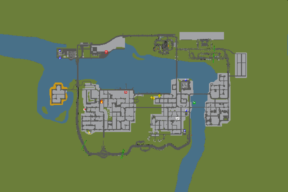
The file that started the biggest surprise: a complete, differently illustrated city map in _NOTINUSE_MAP/_CITYMAP.MAP.
The artwork is real and its source is explicitly labelled NOTINUSE. Its development date and beta provenance are unconfirmed. This file contains a 2D map, not a separate playable 3D city.
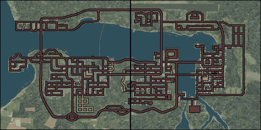
Old artwork and final map
Both maps show the prison island, airport and broadly corresponding city layout. The old image contains more building footprints, vegetation and coloured landmarks. The final version uses textured terrain and prominent road outlines.
How we reconstructed it
The 551,936-byte file contains 176 blocks of 3,136 bytes. Each block stores a 96 × 64 four-bit indexed image and a 16-entry palette. The blocks form 16 columns and 11 rows, advancing 32 pixels between windows. Every overlapping pixel agrees, allowing an exact stitch into a 576 × 384 image.
The retail map was decoded separately from the MISC.DOB embedded in MERGED/DAY_STD.MRG. Its BIG_MAP1 and BIG_MAP2 texture sections provide the two halves of the final 512 × 256 image.
What differs—and what remains open
The illustration style, framing, resolution and level of detail visibly differ. Those differences alone do not establish changed 3D roads or buildings. A raw image subtraction would mix drawing changes with potential layout changes.
The next step is landmark alignment, followed by coordinate-based visits to candidate differences in the retail city. No alternative playable map or verified changed 3D location has been established from this artwork yet.